Page Header Schedule
Tipping
Climate Triad
Contact Page

Steering Circle Members
Why We Are Here
Who We Are
Cooling Solutions
What Is Geoengineering
![]()
Forest clearing, beginning about 8,000 years ago, removed 40 percent of global forests by 3,000 years ago and 50 percent by 250 years ago, with an additional 10 percent removed to today. Prior to human’s fossil fuel emissions, forest removal, prevented sequestration, and subsequent animal husbandry and agriculture, created about 1 degree C of warming, contributing to the longest interglacial warmth period known, that allowed humankind to advance our civilization from half a billion to eight billion souls. Clearcut forest, Joseph Kellerer, Unsplash, Creative Commons.
Risks
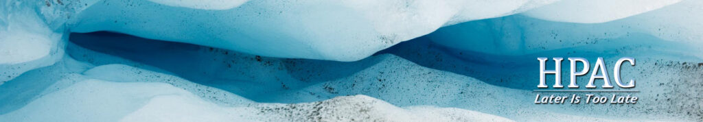
A crevasse on the Greenland Ice Sheet. Crevasses can be deadly, but often in the warm(ish) season, snow that hides the peril is melted or ablated away. The edges of the crevasse may be pitted with small razor edged inch-wide depressions that threaten with only the smallest amount slipperiness. Crevasses can be relatively shallow, or they can extend to bedrock, thousands of feet below. They often serve as drains for meltwater on the surface, with interconnecting crevasses deep within the ice serving as a plumbing system to shunt almost all meltwater to the bottom of the ice. This melt water accumulates enough that it can actually float the ice sheet up above its bedrock base and lubricate its flow to the sea. This action mostly happens in abrupt movement events where the ice sheet can surge tens to hundreds of feet before stopping. in a tremendous earth, or rather an icequake, of up to magnitude 5.1 on the Richter scale, or enough to badly disrupt a settlement in a developing nation.
Ethical Considerations
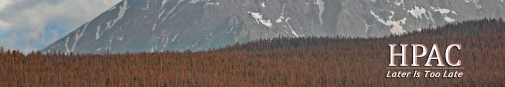
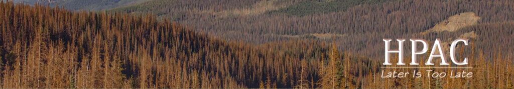
Red kill, lodgepole pine (Dendroctonus ponderosae) Central Colorado north of Silverthorne on I70. Over 100,000 million acres in western North America have been killed by native bark beetles since the turn of the century. The cause is water stress from warming. This continental-scale attack is now waning as the mountain pine beetle has destroyed almost all large stands of its preferred hosts of ponderosa and lodgepole pine. Beginning about 2015, attacks from native fir and spruce beetles began ramping up and are now comparable to the worst of the mountain pine beetle’s attack.
Pushback
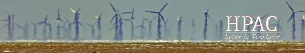
Wind turbines in South Texas, seen from Padre Island National Seashore. The Laguna Madre, between the Seashore and the mainland, is a narrow body of water a mile or two wide at most that extends over a hundred miles landward from Padre Island from north of corpus Christi to Brownsville and the Mexican border. The wind turbines line the mainland just inland of the Laguna shore. Atmospheric conditions in this image created a mirage that optically raised the foreground so that it appears the wind turbines are under water. This makes for a great photo, but it is a mirage, not real; not photoshop.
Climate Restoration
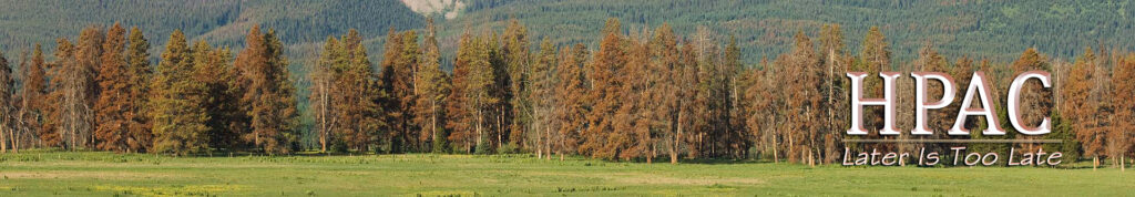
Steamboat Lake State Park, near Steamboat, Colorado. A field of alpine sunflowers set against an extreme mountain pine beetle kill in lodgepole an ponderosa pine.
What Can I do
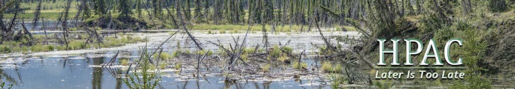
Permafrost Thaw, Glenn Highway, Alaska. Most permafrost is mostly ice. When it melts, it creates lakes with drowned vegetation. Sometimes the lakes drain away leaving bombshell-pockmarked landscapes. Sometimes they remain lakes. All emit fossil greenhouse gases in large quantities when thawing and thawing has just begun. Most is extremely deep with depths up to a half mile in Alaska and a mile in Russia.
Climate Tracking
Permafrost Thaw, Glenn Highway, Alaska. Most permafrost is mostly ice. When it melts, it creates lakes with drowned vegetation. Sometimes the lakes drain away leaving bombshell-pockmarked landscapes. Sometimes they remain lakes. All emit fossil greenhouse gases in large quantities when thawing and thawing has just begun. Most is extremely deep with depths up to a half mile in Alaska and a mile in Russia.
Coalition Work
Permafrost Thaw, Glenn Highway, Alaska. Most permafrost is mostly ice. When it melts, it creates lakes with drowned vegetation. Sometimes the lakes drain away leaving bombshell-pockmarked landscapes. Sometimes they remain lakes. All emit fossil greenhouse gases in large quantities when thawing and thawing has just begun. Most is extremely deep with depths up to a half mile in Alaska and a mile in Russia.
Reduce – Sustainable Emissions
Wind generators in South Texas as seen across the Laguna Madre from the back island flats on Padre Island.
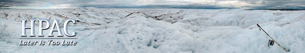
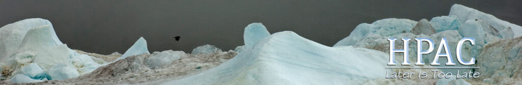
A mile inland on the Greenland Ice Sheet, near Point 660, 18 miles from Kangerlussauq on the east coast, down the longest road in Greenland, near the Arctic Circle. The darkest discoloration is from rock ground off by the ice sheets’ movement and twisted up to the surface by ice turbulence form bedrock obstructions. The rest of the dark coloration is dust from up to a hundred millennia, from as far away as Siberia. the dust mostly stays on the surface as the ice melts because it is trapped in uncountable small inch-size depressions in the ice caused by extra melt from the warmth absorbed by the dust. the ice sheet is about a 1,000 feet thick here.